A Yes, Not a No...To Mt. Capistrano
Mt. Capistrano
Malaybalay,
Bukidnon
My
first Bukidnon trip was March this year, when my SO2 girlfriend Gracie got wed
in Cagayan de Oro. The day after the wedding, Sarge, my roommate in UP Kalayaan
Dorm, toured me and fellow SO2's to the different tourist spots in Bukidnon. It
was only a day trip, yet, we were able to visit Dahilayan and Malaybalay. We
arrived in Malaybalay late afternoon, thus, had limited time to discover the
city. I promised myself back then that I'll be back to Bukidnon and spend more
time specifically in Malaybalay. Little did I know, that seven months forward,
I'll be attending another destination wedding, to be set in the picturesque
city of Malaybalay.
For
this Bukidnon wedding (#ROBwedsNICE), I allotted more time so that I would be
able to squeeze in a few side trips. And that includes an early morning hike to
Mt. Capistrano.
Standing
at 610masl, Mt. Capistrano has become Malaybalay's favorite day hike for
newbies and seasoned hikers alike. The trails are easy and the stunning views
of Bukidnon from the peak are very much worth the hike. It is also easily
accessible from Malaybalay city proper, and can be seen as the most prominent
minor summit visible from Bukidnon highways.
 |
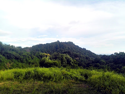
| Mt. Capistrano seen from the barangay road that leads into the registration point. |
The
day after the wedding, D and I drove to the registration area at Sitio
Binalbagan. We paid 20 pesos each as registration fee and additional 500 pesos
for a guide. It is easy to climb the mountain without a guide given its well
established tracks; however, as per new ordinance from the barangay, a guide is
required for all trekkers. I have no qualms about this because it's a form of
supporting local economy.
So,
together with our guide, we started our hike to the mountain. The first part is
passing through a papaya plantation leased by DOLE, the big canning company. I
believe those papayas are used in DOLE's fruit cocktails, the main ingredient
in fruit salads. After the plantation, the next part of the trail is the 292
concrete stairs which also served as warm-up to our knees.
 |
| The concrete stairs marking the start of ascent. |
Next
is an open trail, which is difficult, because of the steep slope. For the first
300 meters, a rope is installed in the middle of the trail to assist hikers. In
this part, I put on my gloves to prevent getting blisters from the rope.
After
the open trail, we entered a forested trail. It was raining the night before,
so the trail was muddy and slippery. In here, we began to meet descending
hikers. I was so shocked to see some in their slippers, shorts and tank tops.
It seemed they just got from the beach and not in the summit.
Limestone
boulders started to appear, getting larger as we approached the summit. . This
is probably the most dangerous part of the hike where climbers hop from one
rock to another, sometimes, gripping the sharp limestone edges for added
balance. Gloves are really required in this part to avoid abrasions and scrapes.
Finally,
here comes the karstic summit. Limestone formations adorn the peak, and usually
where the climbers stand or sit and just do their buwis-buhay instagram-worthy
shots. The view at the top is exhilarating offering a 360 degree view of
Bukidnon lowlands dotted with green rice paddies. The Kitanglad range is also
visible from the peak. But not everyone is lucky, sometimes the summit is shrouded
with fog, no clearing means no good views. I was beyond lucky that day, for I
was given clear, blue skies during my Capistano hike.
 |
| Mesmerized with the view at the summit. |
 |
| Rice paddies of Bukidnon were seen from the summit. Kitanglad Range was also partially visible from the peak. |
 |
| Hindi sa pagmamayabang but these kids asked if they can have a picture with me and that's a #feelingartista moment for me. Hahaha! |
After
Mt. Capistrano, D and I proceeded to Impasug-ong for Pamihawa ridge, then,
drove straight to Dahilayan for a quick visit. We went back to Agusan via
CDO-Butuan road, and since we took Tagum-BUDA highway on our way to Bukidnon,
we just closed the eastern-central Mindanao road circuit. Yay to Mindanao road
trips!
So,
did I enjoy this Bukidnon trip? Very! Super! Yes! For it's never a NO...for Mt.
Capistrano.
Climb
Date: October 22, 2017
Summit
Elevation: 610mASL
Difficulty
Rating: 3/9
Jump-off
Point: Sitio Binalbagan, Brgy. Simaya
Exit
Point: same - back trail
Days
Required/Hours to Summit: 0.5 day/1.5 hours
Features:
Steep rocky trail, limestone summit
Geology:
Limestone underlain by feldspar porphyry
Guide:
Mandatory guide assigned at the registration area
Contact
Person: none, easy to DIY


Comments
Post a Comment