Mt. Ulap
Itogon, Benguet
 |
| I am not so afraid of heights! |
One of the
benefits of hiking is widening your social circle. When I hiked Mt. Katayagan a
few months back, I met some Baguio mountaineers through
my friend Ronald. We agreed that they will take me to Mt. Ulap by November.
During my work break that month and just a week after climbing Mt. Apo, I
finally set foot to Mt. Ulap.
Standing at
1846masl, Mt. Ulap is the favourite mountain for a day hike in Benguet province
with only 40 minutes drive from Baguio City. It is also easy to arrange the
hike DIY style, no need to book for organized tours.
Leaving Agoo
very early in the morning with my trustworthy FiFi (my car), Ronald and I
picked up Ganie Moore (Mogs) in Baguio City. We dropped by at an eatery in
front of Sitel Call Center in Loakan Road and had a breakfast of eggs and hot
dogs. After eating, I continued driving
and took the road going to Philex Padcal mines. During the trip, we rolled down
our windows and enjoyed the pine scented breeze and scenic views dotted with
vibrant sunflowers. I remember Mogs talking about his "napurnadang"
love life!!! Hahaha.
We arrived at Ampucao
barangay hall around 7am and we registered our names right away and paid 100Php
each. A local guide is mandatory and so we hired one for 600PhP. Since I
brought Fifi, we also paid for additional parking fee. After 30 minutes in the
barangay hall, we started the trek.
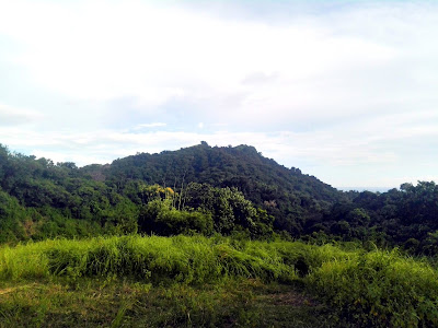
The trail can
be divided into four segments. The first part is a pine forest leading to the
first peak called Ambanaw Paoay. It starts with a steep trail that will definitely
make you catch your breath. There's also a view deck where the second and third
peaks of Mt. Ulap eco-trail can be seen.
 |
| The pine forest trail. |
 |
| View from the view deck. |
 |
| Man-made rock displays at the first peak. |
 |
| Always a Mautaineer. |
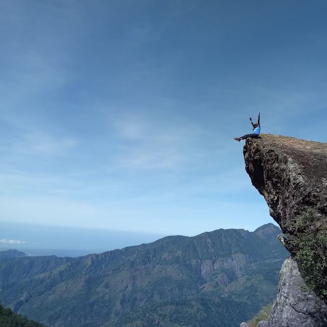
The second
segment is composed of hilly grasslands leading to Gungal Rock which is the
second stop along the eco-trail. Gungal Rock is the most famous among the three
peaks for it features a metaconglomerate overhang where tourists and hikers
alike line up for a buwis buhay shot. Gungal Rock, seen from a lower angle,
resembles Pride Rock in the Lion King movie wherein the newborn Simba was held
by Rafiki for all the animal kingdom to see.
 |
| Gungal Rock. |
 |
| Trail to Gungal Rock. |
 |
| Lone tree. |
 |
| Rest stop. Winds were blowing so hard that day. |
The third
segment is an open grassland leading to the third peak which is the actual
summit of Mt. Ulap. A marker was in place boasting the 1846masl elevation of
Mt. Ulap. Since the peak is an open grassland, a panoramic 360 degree view of
the surroundings can be experienced. Prominent features are Kennon Road, Baguio
City, Philex tailings dam, San Roque dam and Mt. Arayat just to name a few.
 |
| Conquered my first Cordilleran mountain. |
 |
| A view of Philex tailings DAM 4. |
 |
| Mt. Ulap's peak. |
The last
segment is a forested steep descent dotted with sari sari stores down to the
exit point. There is one store named 7-11 because it is open 24-7 (open at
night time for campers). I observed that as you go down, the price of goods and
merchandise get cheaper. It was amazing to see souvenir dri-fit shirts sold on
this segment of the trail.
 |
| Herding my cattles. |
 |
| Mt. Ulap's 7-11 shop. |
 |
| One of the many hanging bridges leading to the exit point. Notice the doggie too. |
Mt. Ulap is
special to me for it is my first Benguet mountain - my initiation to the beautiful Cordilleras.
Composed of pine forest trails and open grasslands, the hike is scenic, from
start to finish. But the best thing I loved about Mt. Ulap is the cool, crisp
air. The air is very clean and if my memory serves me right, it could be the
cleanest air I have ever breathed. Another positive I observed in this mountain
is the absence of trash to which our guide disclosed that they conduct a
regular clean-up drive in order to maintain the cleanliness of the eco-trail.
 |
| My Kamote and vlogger friend Ronald. |
After the hike,
my friend Ronald treated me to a lunch of Baguio's best bulalo paired with ice cold
coke. Dapat lang! Cos I drove back to Agoo while he slept soundly in the
passenger seat.
Climb Date: November
16, 2017
Summit Elevation: 1846mASL
Difficulty Rating: 3/9
Jump-off Point: Brgy.
Ampucao, Itogon
Exit Point: Brgy.
Sta. Fe, Itogon
Days Required/Hours to
Summit: 1 day/2-3 hours
Features: Pine
forests, open grasslands, scenic ridges
Geology: Metasediments
Guide: Mandatory
guide assigned at the registration area
Contact Person: none,
easy to DIY
Tayo


Mcenvelpropbe_Omaha Peris Duncan Download
ReplyDeleteeruaphsacbull
caesaQin-se_1997 Jay Diaz Wondershare Repairit 4.0.5.4
ReplyDeleteLuminar AI
Abelssoft SyncManager Pro 2022 21.01.35145
McAfee Internet Security
garfperwifit